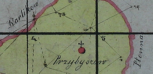
Available here are nine connected maps of Prybyshiv (Прибишів) in 1852 that one can print and assemble into a single large map which shows most of the village. The Austrian government created these cadastral maps (see a dictionary definition of cadastral) but unlike most government documents, they're beautifully drawn and colored by hand. Thanks to Marie Hughes for sharing these maps with us.
Unfortunately these maps were poorly digitized – someone at the archive just put them on a table and photographed each map with a digital camera. As a result, they're somewhat fuzzy. The lot numbers (which are the most interesting information) take some work to read.
| Low Quality | High Quality | |
|---|---|---|
| Map I | 164K | 6M |
| Map II | 127K | 6.6M |
| Map III | 127K | 6.2M |
| Map IV | 229K | 8.1M |
| Map V | 217K | 5.8M |
| Map VI | 82K | 5.1M |
| Map VII | 164K | 7.1M |
| Map VIII | 102K | 5.7M |
| Map IX | 86K | 5.3M |
There's also a single overview map which doesn't contain any useful information but you might like to see it anyway. Especially if you're like me and you love the way these old maps look.
About the Lot Numbers
The numbers on these maps are not house numbers, they're lot numbers. The list of lot owners is long and resides in the archive in L'viv. I don't know of another source. We have a few select pages on this site.
About Printing
You can print these on your home printer but you'll use a lot of ink and might not find the result very satisfying. I recommend that you take the high-quality map files to your local print shop and ask them to print the maps for you. You might want to print this page and bring it along with you. Printed at 300dpi (good quality), the largest sheets (like #4 in the middle) will be about 8.3" x 6.8" (21.1 x 17.4cm).
Connecting the Maps
Once you have printed the individual maps, the diagram below shows how to arrange them.

Click on the image for a larger version.


